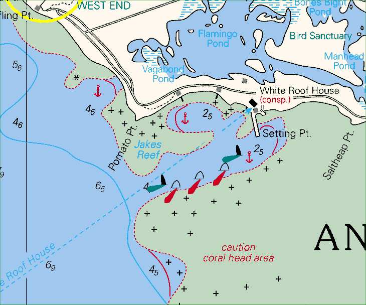
If you have CYC, Maptech, or C-MAP charts, then
be aware that the Anegada entrance channel as charted on these charts is incorrect.
The channel shown on those charts is the entrance channel prior to 1992. In 1992,
new channel markers were placed and the channel was set slightly farther to the southeast.
Below is snippet from the chart as it should be showing the correct entrance
channel.

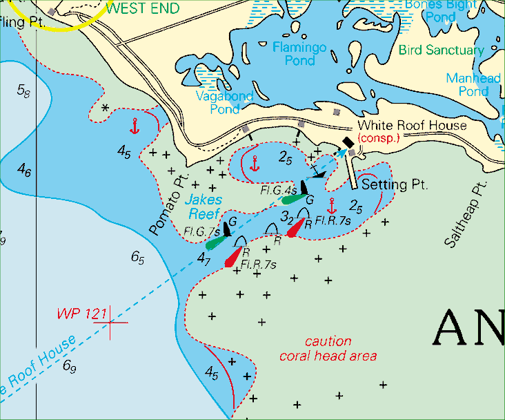
The chart with the old incorrect
entrance channel is shown below. Take serious note: the position of the green
inner buoy (northernmost green buoy) as charted on the chart is actually at the shallowest
spot in the Setting Point anchorage! The water at that position is only five feet
deep.

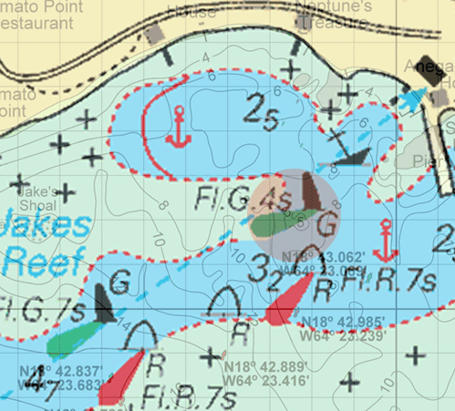
The enlargement below shows
the area in the light red circle, with my Anegada
Approach Chart superimposed over it.


NOTICE THE INFORMATION AND DATA ON THIS PAGE ARE PRESENTED FOR SUPPLEMENTARY REFERENCE ONLY, AND ARE NOT INTENDED AS A MEANS OF OR SUBSTITUTE FOR PROPER NAVIGATION AIDS. UNCHARTED AND UNMARKED HAZARDS EXIST. USE AT YOUR OWN RISK. DO NOT ATTEMPT PASSAGE TO ANEGADA WITHOUT APPROPRIATE CHARTS, BRIEFINGS, AND OTHER APPLICABLE INFORMATION. THE AUTHOR MAKES NO WARRANTY, EXPRESS OR IMPLIED, AS TO THE ACCURACY OR COMPLETENESS OF THE INFORMATION CONTAINED HEREIN. |
This page and the
contents thereof are the property of Walker Mangum
Copyright © 2002, 2006 by Walker Mangum
All rights reserved
Images on this page may not be reproduced without the express consent of Walker Mangum
You are welcome to create links to this page.